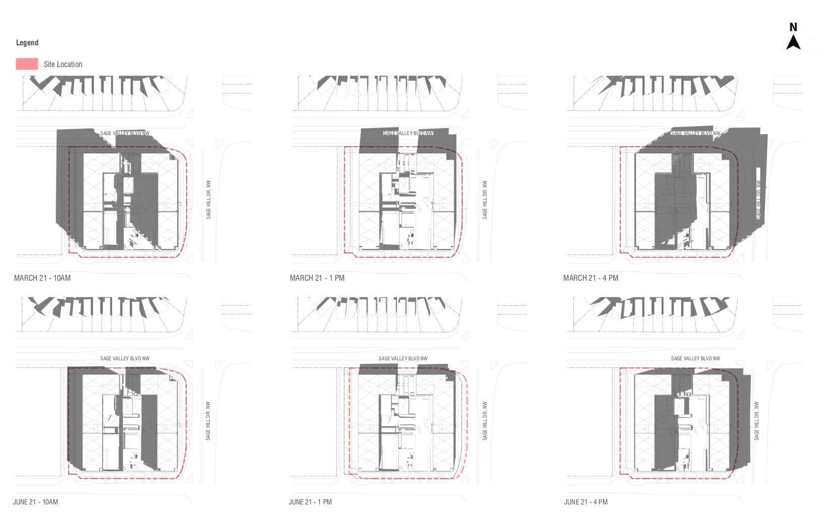
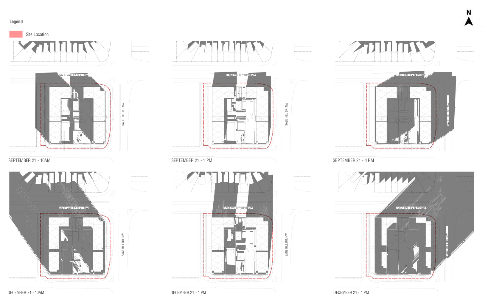
.
SAGE HILL CROSSING
.
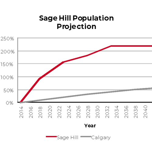
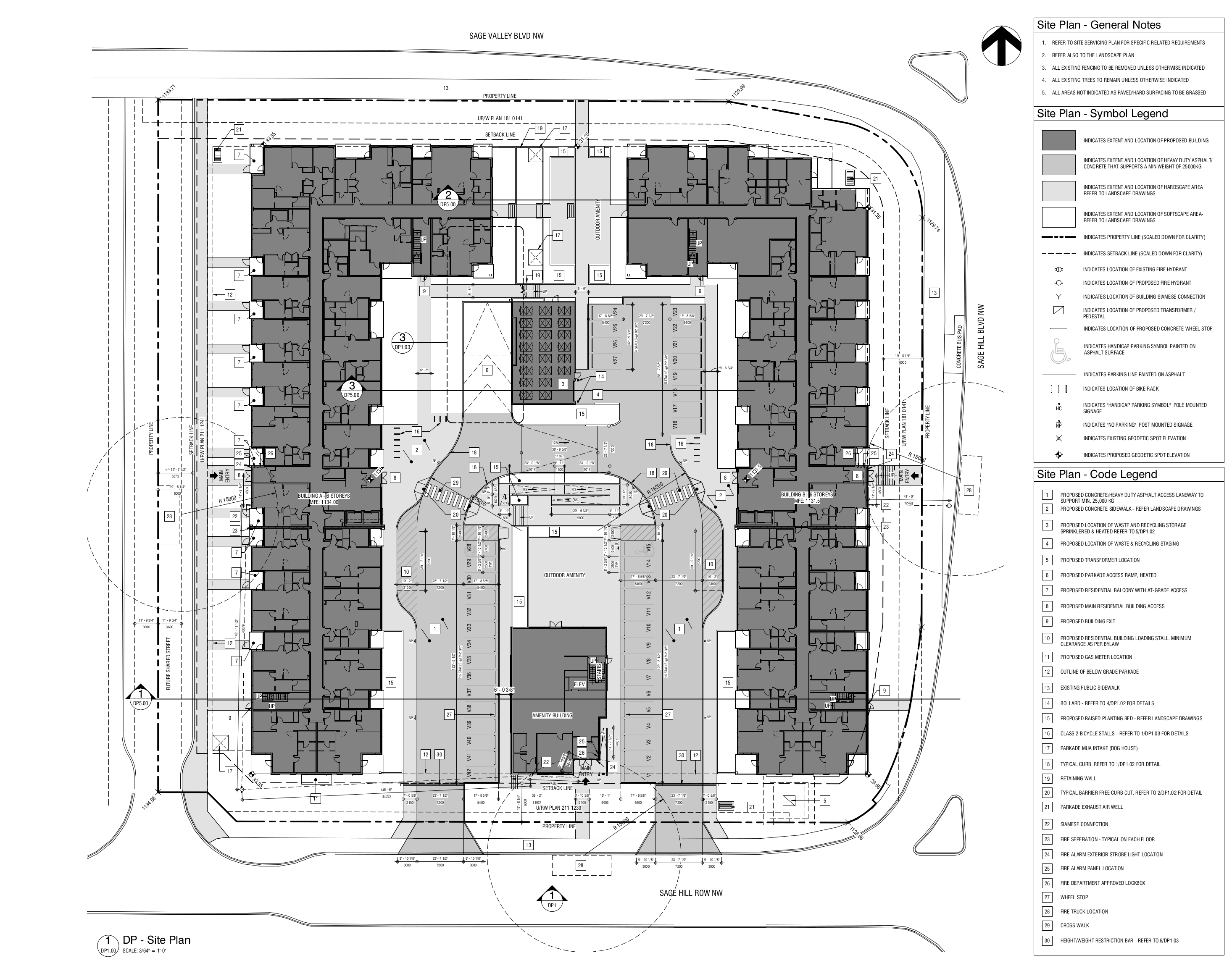
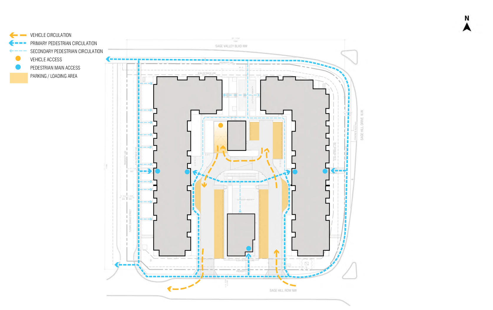
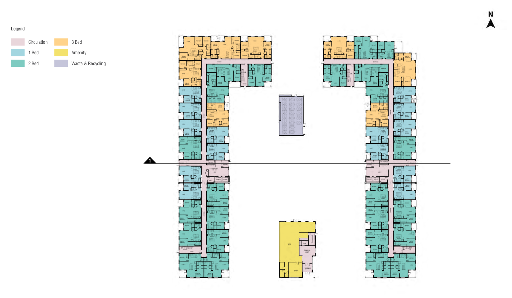
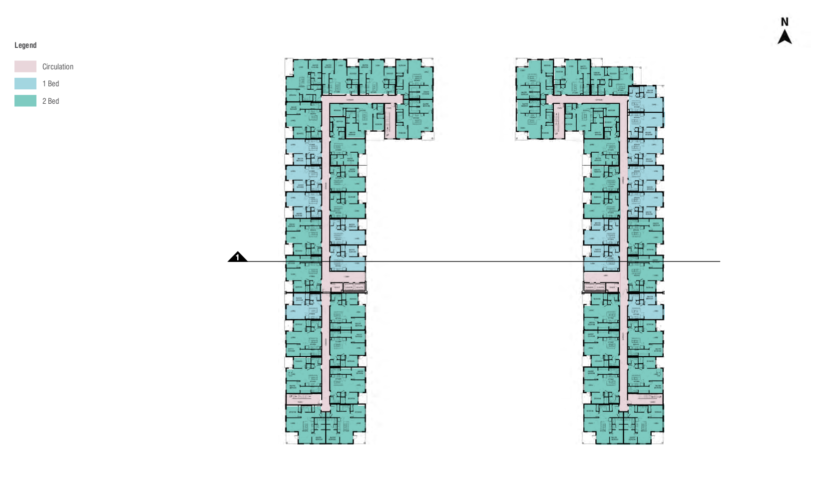
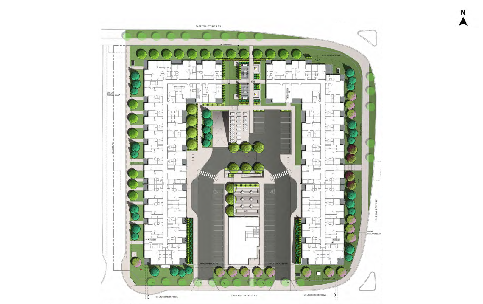
Sage Hill Crossing will consist of 2 mid-market rental buildings targeting folks looking to downsize, younger families, and working singles. 290 total units range from ~590 sft 1 bdrm to ~800 sft 2 bdrm, and ~1200 sft 3 bdrm units. In-house amenities include a gym, office space, and bookable social space. This development will complement the original area vision as laid out in the Symons Valley Community Plan, by bringing in greater residential density to complement the surrounding uses and amenities.
Do you have any question or comments?
Contact our team at Hive or please email Srimal at srimal@hivedevelopments.ca
.
WHO ARE WE?
Spray Group is a boutique real estate developer located in Calgary, Alberta. Led by professionals with many years of industry experience, we focus on developing two or three special projects each year.
S2 Architecture is designing Sage Hill Crossing and is an architectural, interior design and master planning firm with studios in Calgary, Edmonton, and Vancouver.
B & A Planning Group is one of Western Canada’s leading community and land development firms with over 30 years of experience facilitating projects in both the public and private sectors.
Hive Developments which will be conducting engagement and project-related communications is an urban planning consultancy located in Calgary. Our core planning and outreach team offers expertise in land use re-designations, facilitating permits, and community consultation. We help clients and communities through the planning process to ensure all stakeholders voices are heard.
.
2.83
2.47
residents/dwelling
20%
23%
total housing stock that are apartments
1.8
1.5
average residents per apartments
12%
13.6%
of residents live in apartments
.
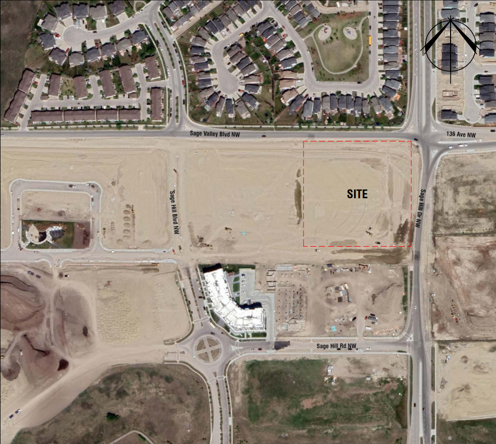
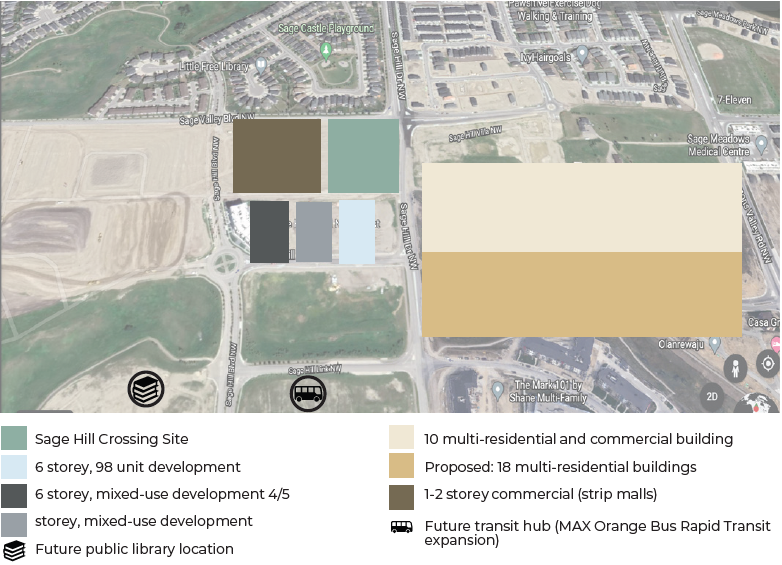
The site of Sage Hill Crossing is located within the designated Mixed-Use Area of Sage Hill, which is also intended to be accessible by frequent transit routes (such as a Bus Rapid Transit service) in the future. Therefore this area is intended for a mix of retail, commercial, office and residential uses, where each residential building can have a maximum height up to 10 storeys, and the average residential intensity is expected to be 150 people/jobs per hectare.
As shown in the map above, this area is moving toward one of:
- Higher general residential density
- Mixes of residential and commercial uses
- A mix of building forms, ranging from lower density forms (rowhouses) to medium-density forms (5-10 storey apartment buildings)
- Good connectivity to regional walking and cycling pathways
- Good access to higher frequency transit
.
PROPOSED PROJECT
The project requires a zoning change, for which B & A Planning group submitted an application, and a development permit for which S2 Architecture submitted an application. Both are currently under review.
ZONING CHANGE
We believe Sage Hill Crossing will be a welcome addition to north Calgary as it will benefit future and surrounding area residents by:
- Further diversifying the housing mix in the community;
- Generating demand, and thereby improving the viability of existing and future local
commercial development in the area; and -
Supporting public investment in important amenities, such as Bus Rapid Transit, a public library, and other neighbourhood institutions. E.g. bringing in the minimum 10,000 community residents required to initiate the development of a local elementary school
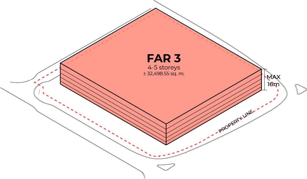
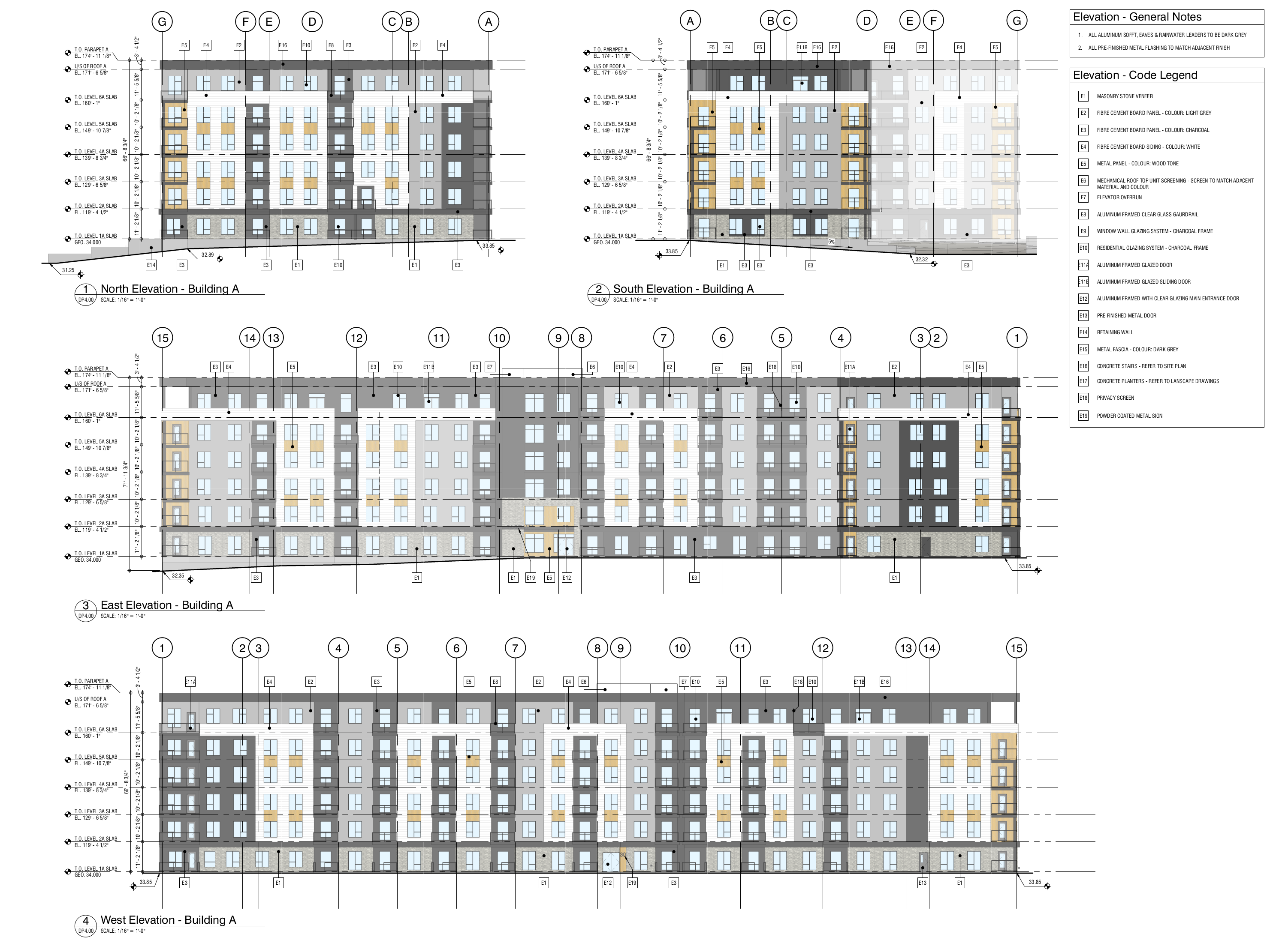
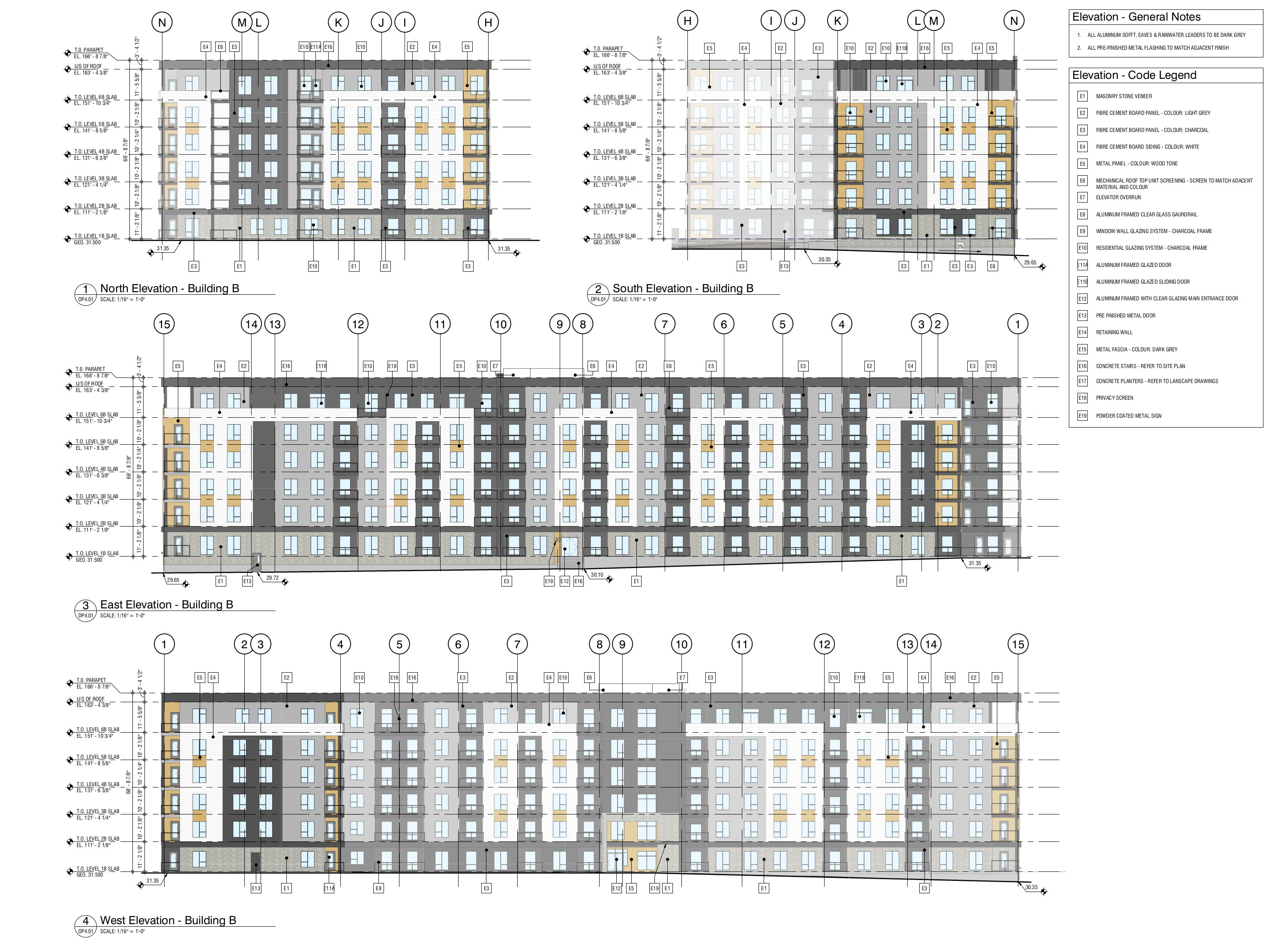
The subject site is approximate 1.30 hectares (3.22 acres) in size and is currently zoned for multi-residential development of medium height and density (M-2). The maximum height permitted under this zoning is 16.0 metres which could accommodate 161 units, in a 4 – 5 storey buildings. Sage Hill Crossing is intended to be a 290 unit residential development on the subject site of up to six storeys, and 20-22 m in height for purpose-built rental. Therefore the site will be rezoned to allow for High Density, Low Rise multi-residential development (M-H1).
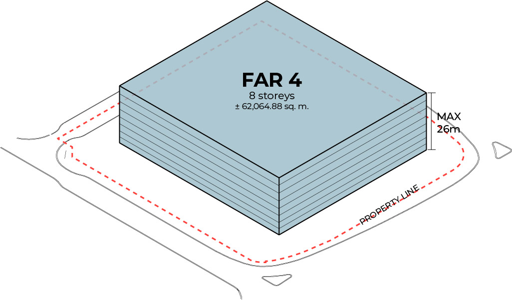
As shown in the figure above, the figure in red outlines what the basic blocking of the building on this site could look like, if built to maximum height and lot coverage, according to existing zoning regulation. Conversely, the figure in blue outlines the same, if built according to desired zoning regulation. Note these are simply basic outlines to scale, devoid of any specific design details, which will be laid out as this application progresses.
.
SITE DESIGN: AT A GLANCE
Current Zoning
Height
Max. 16 m/4-5 storeys
Intensity
Max. 3 FAR
Density
Min. 60 units/hectare
Parking
Min. 110
Min. 47
Proposed Zoning
Height
Max. 26 m/8 storeys
Intensity
Max. 4 FAR
Density
Min. 150 units/hectare
Parking
Min. 378
Min. 174
Proposed Development
Height
Max. 20-22 m/6 storeys
Intensity
2 FAR *
Density
224 units/hectare
Parking
344**
175
*Floor to Area Ration (FAR) implies that the maximum developable floor area allowed for this site is 4 times the area of the lot, while the proposal is only 2 times the area of the lot.
**The proposal is requesting an 8% relaxation on parking provided, due to the site being within a 600 m walk, on defined pedestrian pathways, of an approved Bus Rapid Transit (BRT) station. The current land use bylaw allows up to a 10% relaxation under these conditions.
.
ARTISTIC RENDERS
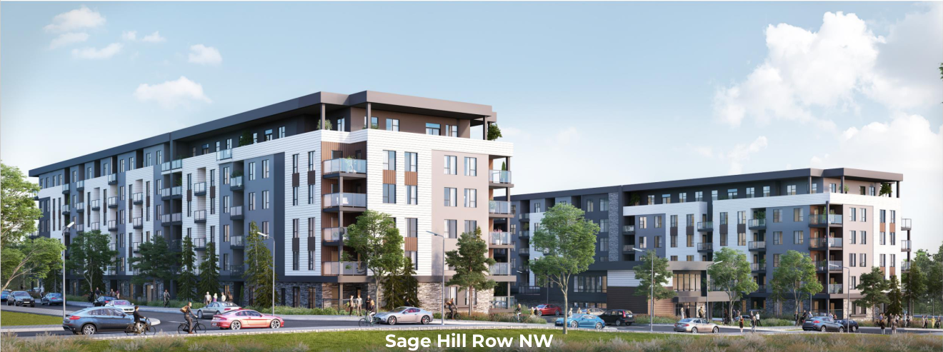
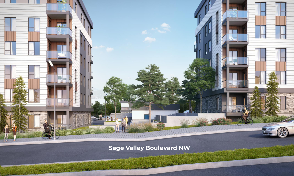
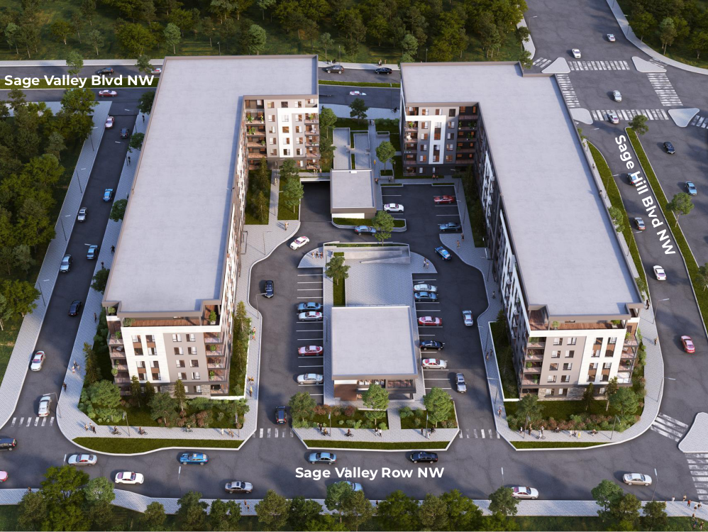
The following images are artistic depictions of what the site would look like once its development is complete.
Street level view of the south west face, with north eastern orientation
Street level view of the north face, looking southward into the site
Aerial view with north orientation
.
.
.
IMPORTANT DATES
Engagement Process
Rezoning & Development Permit (DP)
Applications Submitted
Planning Commission Hearing for Rezoning
Planning Commission Hearing for DP
Rezoning Public Hearing
DP Public Hearing
Construction Begins
Development Completed
Engagement Process
Rezoning & Development Permit (DP)
Applications Submitted
Planning Commission Hearing for Rezoning
Planning Commission Hearing for DP
Rezoning Public Hearing
DP Public Hearing
Construction Begins
Development Completed
UPCOMING EVENTS
Please signup to receive meeting links for the following digital Open House which will take place via zoom
Online Open House
February 10th, 2022
8:00 PM – 9:00 PM MST
Register here
![]()


